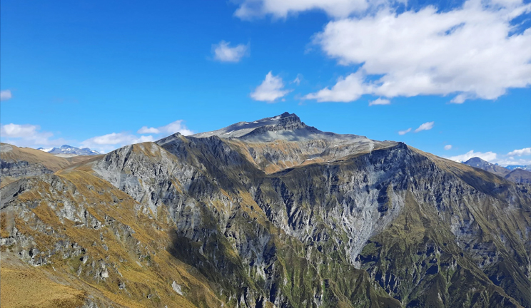
The Kalanag Expedition, also known as the Black Peak Expedition, has become a coveted adventure for many, with climbing this majestic mountain being a lifelong dream for many enthusiasts. Located in the picturesque Uttarkashi district of Uttarakhand, it stands tall at an impressive 6387 meters, connected to the Swargarohini and Bandarpoonch peaks. The expedition begins at the base camp in Sankri, with Ruinsara Tal and Kyarkoti as the trek’s starting points. The mountain’s unique slope, resembling a snake, prevents snow from settling, giving it a black appearance from the front, earning it the name Kalanag or “Black Cobra” in the local dialect. As the highest peak in the Saraswati Mountain Range, it’s surrounded by notable peaks, including Bandarpoonch (I) and Hanuman Parvat (Bandarpoonch II), forming a breathtaking mountain range near the Ruinsara Valley.
Trekking
Black Peak, the highest point in the Saraswati Range of the Garhwal Himalayas located in the Ruinsara Valley, is a testament to the thrill of mountaineering. Known locally as Kalanag due to its resemblance to a black cobra’s head, this peak reaches a height of 6,287 meters. The Bandarpunch massif, which includes White Peak (Bandarpunch II), Banderpunch I, and Kalanag (Black Peak), offers a challenging climb with its imposing structure. Black Peak’s allure and demanding ascent make it a coveted summit for avid mountaineers.Trek Location:
Black Peak is not just about the climb but also the journey. The trail offers breathtaking views of prominent peaks in the Garhwal range, such as Swargarohini, Bhagirathi Massif, Bandarpunch, and the Gangotri range. Passing through Govind National Park, known for its rich variety of animal life, the trail offers incredible beauty across diverse landscapes, including alpine meadows, pine forests, moraine ridges, boulders, and glacial basins.Trek Type:
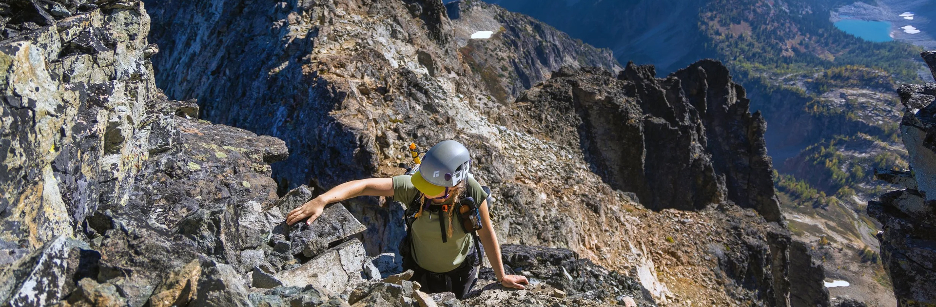
Black Peak presents a captivating combination of aesthetics and difficulty. While the entire expedition is technically demanding, the most formidable obstacle is a steep 75-foot ice wall with a 70-degree incline between you and the summit. The journey involves: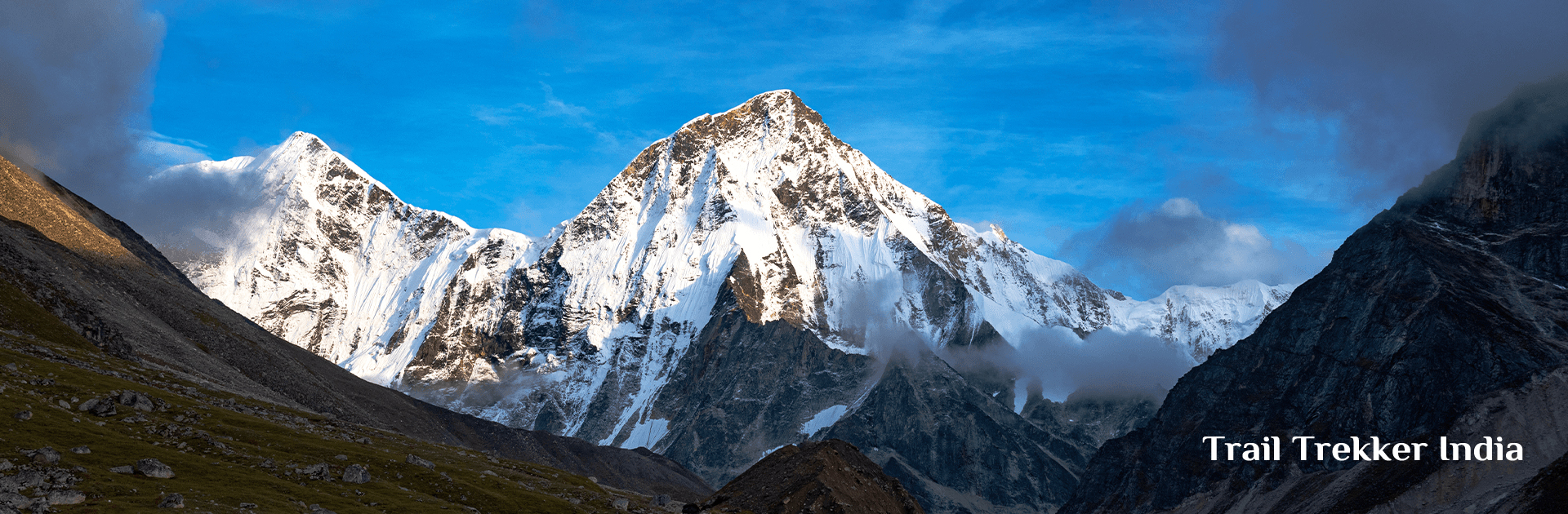
Once you have registered with Trekup India for a journey from Dehradun to Sankri, the day starts early. We will meet at the designated spot by 7 a.m. to begin our extended trip to Sankri – a popular trekking destination in the Garhwal region of Uttarakhand. Today’s schedule involves a 9-hour drive and acclimatizing to the mountain environment. Departing early is advisable for two key reasons:
First, we aim to arrive early to allow our bodies sufficient time to rest before the upcoming day. Second, mountain roads are known for their unpredictability, so it is wise to factor in potential delays at the beginning of our journey. It’s also preferable to reach our destination before nightfall.
Nestled in the heart of majestic mountains, Sankri is the primary departure point for numerous trekking expeditions, attracting adventurers throughout the year. This quaint village is the launching pad for iconic trails like Har ki Dun, Baraadsar Lake, Bali Pass, Kedarkantha, Dev Kyara, and Phulara Ridge, offering breathtaking journeys through the region’s most spectacular landscapes.
The journey from Dehradun takes us along picturesque mountain routes. These gentle roads, despite their winding nature that may cause slight motion sickness, are a sight to behold. The varying scenery at every twist and turn is a captivating distraction. The sights of towering trees, expansive fields, and terraced mountain slopes used for farming are too stunning to overlook in favour of rest. While passing through sizable towns, the drive also transitions between small sections of bustling streets lined with village stores and lengthy deserted stretches filled only with the soothing sounds of the wind and birds.
The oscillation between bustling noise and peaceful tranquillity brings a unique calmness. Moreover, stopping at local eateries along the way allows us to savour the flavours of regional specialities for breakfast and lunch. The final stretch of the drive is a breeze, winding through a picturesque road flanked by dense forests that revive us after the long journey. The forest’s radiance is enough to rejuvenate us as we approach our destination. As a hub for many popular treks, Sankri offers ample amenities. Although phone connectivity is scarce in Sankri, you can likely find a market stall willing to provide wi-fi access in case of an emergency. Rest assured, you’ll have all the necessary facilities to make your stay comfortable and enjoyable.
At the conclusion of this demanding trek, we will be welcomed to a welcoming homestay made of wood, with comfortable accommodations and a homemade meal.
Get yourself ready for today’s expedition. Our professional leader will provide a briefing and all the details. Complete the necessary documentation, then you can rest or go for a short hike.
After having breakfast, we will leave for Dharkoat village. We will drive from Sankri to Dharkoat village early in the morning. On the way to Dharkoat, you will pass through dense forests as well as beautiful water streams pouring down the roads, and you will also come across the rich cultural village Dhatmeer.
You can hear the chirping of birds and rare species of birds that are found only in the mountains. The state bird of Uttarakhand, the “Himalayan Monal,” is also found in the area of Taluka.
Get ready to enjoy the stunning views of sprawling wild orchids and, if you are lucky enough, you will also encounter the wilderness of the Himalayas, such as leopards, barking deer, boars, and many others.
You will also pass through the small village Taluka while driving from Sankari to Dharkoat village. It’s important to know that Taluka is a small yet beautiful village with traditional house structures and a few dhabas that serve simple and lip-smacking food. After reaching Dharkoat, all the trekkers will rest for some time and then finally start trekking for Seema, which is 4km away from Dharkoat.
On the way, you will also encounter snow in patches where the sun does not get the chance to enter for a long time. It is important for you to know that Seema is not a village but only a shelter point for tourists.
During trekking, you will experience great adventure because at the time of trekking you will not only come across rocky surfaces, but also traditional wooden bridges as well as green trails with the Supin river flowing on your left side.
You will also witness different animals and birds too while trekking that are often found only in mountains. During the trek, you will find several spots of water streams that offer fresh drinking water. By the evening, you will reach Seema via Gangar village.
Just before Seema, all the trekkers will camp on a small green field from where you can enjoy breathtaking views of nature.
The Ruinsara Tal Lake, located at an altitude of 3,500 meters, is highly revered by the local population. It is a stunning highlight of the Ruinsara trek, popular among adventure-seekers heading to the Har Ki Doon Valley. The picturesque lake, surrounded by various alpine flora, is 14 kilometres from Seema. According to local legends, this path was taken by the Pandavas on their way to heaven via the majestic Swargarohini peak, which is visible along the trail. Upon arrival at this beautiful campsite in the early evening, visitors can relax and enjoy the breathtaking scenery.
The impressive Black Peak gradually appears while trekking from Ruinsara Tal to Kyarkoti Base Camp. Kyarkoti Base Camp is a vast expanse of grass surrounded by rocks and snow-covered peaks, with the campsite beside a spring. Experience the thrill as you approach the captivating Black Peak, feeling the excitement build within you. Take a moment to admire your ultimate destination, towering proudly in front of you for the first time during the trek! During the 5-6 hour trek from Ruinsara Tal to Kyarkoti Base Camp, you will gradually catch sight of the impressive Black Peak. Kyarkoti Base Camp is a vast grassland surrounded by rocks and snow-covered peaks, with the campsite located next to a spring. Experience the excitement as you approach the captivating Black Peak and take a moment to admire this ultimate destination, proudly towering in front of you for the first time during the trek!
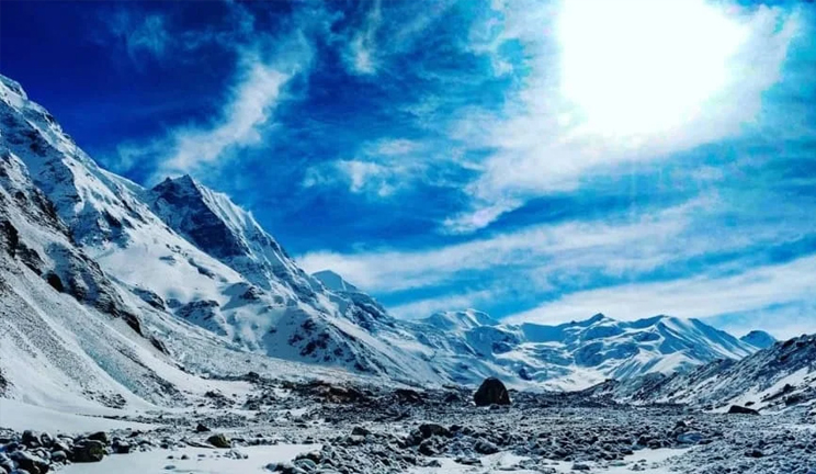
Due to the unpredictable nature of high-altitude environments, flexibility is critical. Plans must be continually reassessed and adapted to suit the prevailing circumstances. As a result, creating a rigid daily itinerary can be challenging. However, the general plan typically involves a cyclical rotation between camps, a standard procedure for acclimatizing on high-altitude expeditions. The ascent of Black Peak involves establishing three camps beyond base camp: Advanced Base Camp at 4,600 meters, Camp 1 at 5,100 meters, and Summit Camp at 5,500 meters.
To successfully navigate high-altitude climbs, expeditions often rotate between camps to facilitate gradual acclimatization. This approach is rooted in the “climb high, sleep low” principle, a crucial guideline for survival in high-altitude environments. For Black Peak, we implement a two-round rotation. On the first day, we transport our gear to the next camp, deposit it, and then return to the lower campsite for the night. The following day, we ascended to the camp, where we left our gear and set up our tents to occupy the site. This tactic yields three significant advantages:
It allows us to distribute our load over two days, avoiding the need to carry excessive weight in a single trip.
It exposes our bodies to higher elevations while giving them time to adapt, reducing the risk of altitude-related issues.
Repeated ascents of the same route enable us to refine our techniques, build our skills, and improve our environmental adaptation.
The expedition will encompass adequate acclimatization, rotation periods, scheduled breaks, and the option for two summit tries if weather conditions are unfavourable.
The ascent from Base Camp (3,820m) to Advanced Base Camp (4600m) presents a significant elevation increase, offering a valuable opportunity to acclimate to the mountain’s slopes and terrain. The route winds through lush grasslands, navigates a rocky section, and tackles a steep incline prone to landslides, eventually leading to a moraine-covered landscape and a glacier. This challenging hike typically requires around 4-5 hours to complete.
From Advanced Base Camp (4,600m) to Camp 1 (5,100m), the landscape unfolds with familiar features – rugged moraines, slow-moving glaciers, and expanses of ice. As you progress, you’ll notice a sense of comfort and familiarity, as if the previous day’s challenges have been tempered, making the journey feel more manageable this time.
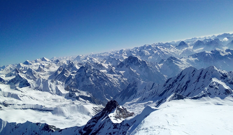
From Camp 1 (5,100m) to Summit Camp (5,500m), the breathtaking vistas of Swargarohini to the north and Bandarpooch to the south serve as a backdrop to a rugged landscape dotted with concealed and exposed glacial fissures. To successfully reach the peak’s summit, it’s essential to acclimate gradually to the harsh environment, navigate the treacherous terrain, and overcome its obstacles.
We embark on the final ascent to the summit in the darkness of night, confronting the biting cold and fierce winds that come with high altitude. The climb is steep and demanding, involving the navigation of near-vertical ice faces with inclines of 70-75 degrees and heights of 75-85 feet, which will require using fixed ropes and jumars for support. Rest assured, our safety is our top priority. In contrast to the peak’s treacherous slopes, the summit itself is relatively flat. Our goal is to reach the highest point of this stunning mountain in 7-8 hours and begin our descent promptly, aiming to return to the safety of our camp before the snow becomes unstable. It’s crucial to exercise extreme caution on the way down, as descents can be even more hazardous than ascents.
We aim to make our initial summit attempt on Day 10, descend to Base Camp by Day 11, reach Ruinsara Tal by Day 12, and arrive at Seema by Day 13 to return to Sankri, where our trek began by Day 14.
As we near the end of our journey, let’s celebrate with a festive gathering at the summit. It’s essential to mark the conclusion of this incredible adventure with a joyful celebration. However, it’s crucial to remember that high-altitude conditions, including the weather, can be unpredictable. To avoid potential logistical issues, we suggest adding some flexibility to your schedule by allowing for a few extra days between the end of the expedition and your return travel plans.
Day 17 serves as a backup day in case of unforeseen circumstances such as inclement weather or unexpected challenges that may disrupt our expedition schedule. It will only be used if last-minute and unpredictable conditions arise, preventing us from reaching our destination on time.
Inclusion
Exclusion